Description of the Western Dvina River according to plan. The source of the Western Dvina River near the village of Sheverevo
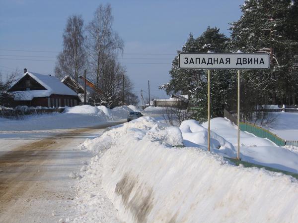
The Western Dvina River is a waterway in the north of Eastern Europe. It flows through the territory of Latvia, Belarus and Russia. The ancient names of the river are Eridan and Khesin. It originates in the Tver region. Here it gradually gains strength in order to rush through three countries and replenish it with its waters. In the Tver region, on the banks of the mentioned river in dense forests, there is a small town of the same name, which is, among other things, the center of the Zapadnodvinsk region.
Ancient city of Western Dvina (Tver region)
The history of this region goes back five thousand years. According to archaeological data, the first settlements here arose in the Neolithic era. An ancient Slavic settlement was discovered on the outskirts of the city, which allows us to make the assumption that even in ancient times, the water resources of the region were used by our ancestors as transport arteries and made these unique places attractive for people's lives. Life has never been calm in these parts; local settlements were regularly attacked by people coming from outside. Baltic Sea Lithuanians. As a result, only by the beginning of the fifteenth century did local residents manage to reclaim these lands and own them for a long 150 years. However, during Livonian War(1558-1573) the struggle for these lands began again. At the first stage, Ivan the Terrible was forced to cede them to the Lithuanian prince Batory. However, by the end of this military conflict, the Western Dvina region was again included in the Moscow state. In the seventeenth century, Polish-Swedish invaders invaded here. It was only by the mid-nineteenth century that a trend of economic and social development emerged in the region.
Modern city of Western Dvina (Tver region)
During numerous wars, the ancient settlement was completely wiped off the face of the earth. And only in the twenties of the last century a village appeared here, and then the urban-type settlement of Western Dvina. The city arose ten years later thanks to a large logging plant built here. Today it is the administrative center of the Zapadnodvinsky district of the Tver region. According to the 2010 census, its population is 10.2 thousand people. A tourist who accidentally gets here will not linger in this god-forsaken “resort town”, and there are a number of objective reasons for this. The only interesting place here is the logging plant, but no one will let you go there anyway, unless you get a job there, but only extreme sportsmen are capable of this. However, this town also has its own attractions: the Museum of History and Local Lore, which is located in local school No. 1 on Kirova Street in house No. 16, active Orthodox Christian church Nicholas the Wonderworker (Shcherbakova Street, building No. 8), built quite recently - in 2008. Of the monuments of history, culture and archeology, only dilapidated churches and archaeological ensembles have survived: the churches of Sergius of Radonezh, the Holy Trinity, the Transfiguration of the Lord and Spasskaya. Perhaps these ruins are of some interest to historians or archaeologists, but they are unlikely to surprise an “advanced” traveler. The tourist infrastructure in the city is completely undeveloped; there are only two cafes with the colorful names “Vovan” and “Yuna”, as well as the restaurant “Dvina”. To be fair, it is worth noting that in this locality there is a ski resort “Mukhino”, but in the summer you will be bored and uninteresting there. As you can see, the assortment is very scarce, and this is understandable, because Western Dvina is an industrial town. But the area is of some interest to tourists. Excursions are organized here to get acquainted with the most beautiful natural monuments: lakes Savinskoye and Vysochert, places where the Chilim water chestnut grows, listed in the Red Book, the ancient Nikopol park, where rare tree species are preserved, and the Veles swamp system. But in most cases, these regions attract lovers of water recreation and fishing. Which is not surprising, because the places here are famous. Not only is the nature very beautiful, but the Western Dvina River is also rich in rare species of fish.
Description of the water body
The Western Dvina has served as a transport route for people since ancient times. The ancient route “from the Varangians to the Greeks” ran along it, which was described in 1114-1116 in the famous “Tale of Bygone Years.” The source of the Western Dvina is Lake Koryakino. The river carries its stormy waters through hilly plains and lowlands left by the movement of an ancient glacier. The total length of this is 1020 kilometers. Every year it carries up to twenty cubic kilometers of water into the Baltic Sea. The lake systems of the basin contain up to four more cubic kilometers of fresh water. This region is very generously endowed with extraordinary attractiveness. Here they reign and cover a quarter of the basin's territory. In the upper reaches of the river, in forest areas, spruce predominates, and in the middle reaches - birch, aspen and alder. Pine forests mainly grow on the Polotsk Plain.
Geography of the river
On geographical map The Western Dvina attracts attention with the rich range of green colors in its pool. It is characterized by numerous lowlands that were once glacial lakes. Narrow sections of the valley, where the river passes through moraine ridges, show the places of their descent. One of the most extensive former lakes is the modern Polotsk Lowland. Its surface is almost flat or gently undulating, in places very swampy, it is composed of ribbon clays and sand. The river valley was formed about 12-13 thousand years ago; it has unformed features. On the territory of Belarus, the width of its channel is 100-300 meters; riffles and rapids are often found here. In some places the valley narrows and becomes canyon-like with a depth of up to fifty meters. But, entering the Baltic Plain, the Western Dvina turns into a deep river, its bed reaches 800 meters in width, and the valley reaches six kilometers.
Pool
The Western Dvina basin is formed by more than twelve thousand small and big rivers. The largest tributary is Mezha, its length is 259 kilometers, and its catchment area is 9080 square kilometers. Most of the tributaries flow from or originate from numerous lakes, thereby forming a very complex hydrographic system. The blue scattering of lakes in some places is united into groups: Ushachskie, Zarasaiskie, Braslavskie. The largest are Osveyskoye, Lukomskoye, Lubanskoye, Zhizhitskoye, Drisvyaty, Razna, Drivyaty. The total area of the lakes exceeds two thousand square kilometers and reaches three percent of the area of the entire river catchment.
Seasonal filling
The Western Dvina is a plain river, its main flow is formed as a result of the melting of snow cover, which accumulates in winter period. This also explains the nature of the runoff distribution of this water artery during the whole year. The spring period is characterized by high water levels, abundant floods, which are accompanied by significant floods, as well as flooding of the floodplain; in addition, this is facilitated by rainy spring weather. By the beginning of summer, the Western Dvina begins to calm down, the waters return to the river bed, and by mid-June a significant decline in water is recorded. During the rest of the year, flow depends on precipitation and groundwater. In summer and autumn, when rainy weather sets in, the Western Dvina can even overflow its banks. In winter, the volume decreases noticeably; at this time the river level is at its lowest, because the basis of its nutrition is groundwater.
Dangerous River
However, you should not think that the life of the river during the winter low water period is so serene. In late autumn, when the river is covered with ice, a sludge boat passes through it. As a result, various dangerous phenomena are created on the water - congestion. The riverbed in some sections can be completely clogged with slush, as a result the river level rises significantly, creating flooding and extensive spills upstream. A similar phenomenon can occur in spring, when the riverbed becomes clogged with ice.
People come and go, but the river flows...
For a long time, people have tried to tame the wayward river and adapt it for their economic purposes. Today, a whole cascade has been created on the Western Dvina, consisting of three large reservoirs. Its rich water resource is used in hydro and heat energy, water supply, transport purposes, for recreation and fishing. These places are rich in monuments of ancient architecture, which are witnesses to many historical events. For example, the oldest Belarusian city - Polotsk - is decorated with the ancient St. Sophia Cathedral. This is an architectural monument of the eleventh century. Simeon of Polotsk and Georgy Skorina lived and worked in the same city, and Peter the Great stayed in one of the houses during the Swedish war. Another ancient city - Vitebsk (the most important trading center on the route “from the Varangians to the Greeks”) - has a thousand-year history.
Fishing on the Western Dvina
This unique corner The Tver region attracts many tourists and lovers fishing. Ecologically clean territory (this is confirmed by the medal All-Russian competition“Ecologically clean area”) is replete with lakes with huge fish resources, which will not leave a single chance for an unsuccessful bite. The Western Dvina River is also unique, covered with forests that make up the bulk of the region’s natural resources. On that water body lovers of chub fishing come together. After all, there is a lot of it on this river; there are even specimens up to three kilograms. Its large number is facilitated by the peculiarity of the river itself: riffles, shoals, islands and huge boulders abound here. All these places attract this fish like a magnet, especially the riffles. In spring and early summer, chub are caught in front of them, at the exit from the pits, and until late autumn - behind them, where the shallows become deeper.
Don't you like this kind of fishing? The Western Dvina is also rich in other fish species, for example, pike and perch. Fans of spinning gear will get an indescribable feeling here. The fishing season begins at the end of May. At this time, the water level in the river drops noticeably, and near coastal zone You can observe a high concentration of medium-sized pike up to one and a half kilograms. It is caught on all types of bait, but prefers Perch; it bites perfectly on small “spinners” (No. 0-2). Mostly specimens weighing 400 grams are caught here. From the second half of summer until mid-October, pike weighing 2-3 kilograms, sometimes more, are caught.
Western Dvina
Material from Wikipedia - the free encyclopedia
(Redirected from Daugava (river))
Jump to: navigation, search
This term has other meanings, see Western Dvina (meanings).
The request for "Daugava" is redirected here; see also other meanings.
Western Dvina
Latvian. Daugava
Belor. Western Dzvina
Western Dvina in Riga
Western Dvina in Riga
Characteristic
Length 1020 km
Basin area 87,900 km²
Pool Baltic Sea
Water flow 678 m³/s (at the mouth)
Source Valdai Upland
· Location Andreapolsky district of the Tver region
· Height 215 m
Estuary of the Gulf of Riga of the Baltic Sea
· Location Riga
· Coordinates Coordinates: 57°03′43″ N. w. 24°01′33″ E. d. / 57.061944° s. w. 24.025833° E. d. (G) (Ya)57.061944, 24.02583357°03′43″ s. w. 24°01′33″ E. d. / 57.061944° s. w. 24.025833° E. d. (G) (I)
Location
Western Dvina basin
Western Dvina basin
Country Russia, Belarus, Latvia
Western Dvina at Wikimedia Commons
Western Dvina in Vitebsk
Western Dvina in Polotsk
Western Dvina (Belarus. Zahodnyaya Dzvina, Latvian. Daugava, Latvian. Daugova, lit. Dauguva) is a river in the north of Eastern Europe, flowing through the territory of Russia, Belarus and Latvia. It is connected by the inactive Berezinskaya water system to the Dnieper River. Ancient names - Eridan, Khesin.
Geographical position
The length of the Western Dvina River is 1020 km: 325 km are in the Russian Federation, 328 in Belarus and 367 in Latvia.
The source of the Western Dvina was finally discovered only in the 1970s. The Western Dvina originates in swamps near the small lake Koryakino, Penovsky district of the Tver region on the Valdai Upland, a few kilometers after the source it flows into Lake Okhvat, then flows first to the southwest, but after Vitebsk it turns to the northwest. The Western Dvina flows into the Gulf of Riga in the Baltic Sea, forming an erosive delta.
Description of the river
The area of the Western Dvina basin is 87.9 thousand km². The total fall of the river on the territory of Belarus is 38 m, the density of the river network is 0.45 km/km², and the lake content is 3%.
The river valley is trapezoidal in shape, deeply incised or featureless in places. The width of the valley in the upper reaches is up to 0.9 km, on average 1-1.5 km, in the lower reaches 5-6 km. The floodplain is predominantly two-sided. The channel is moderately winding, weakly branched, with rapids in places. Above Vitebsk, Devonian dolomites reach the surface and form rapids 12 km long.
The width of the Western Dvina River behind the lake Coverage is 15-20 meters, the banks are wooded, moderately steep sandy loam with boulders, low on the coastal plain. The bed is rocky, with individual rifts and small rapids.
On the Andreapol - Western Dvina section, the width of the river increases to 50 meters, and beyond the city of Western Dvina, having overcome another rapids section, the river receives large tributaries - Veles, Toropa and Mezha, after which it expands to 100 meters.
Behind the mouth of the Mezha there is a large trap intended for collecting timber rafted along the Mezha. Below the river, the river flows in high banks covered with mixed forest. The forest disappears in front of the city of Velizh. Beyond Velizh the river is navigable.
Between the Latgale and Augshzeme uplands, the Western Dvina flows along ancient valley. Here the width of the Western Dvina reaches 200 meters. On the section from Kraslava to Daugavpils there is natural Park Daugavas loki (Bends of the Daugava). Bypassing Daugavpils, the Western Dvina reaches the East Latvian Lowland. Here the flow of the river slows down and the banks become low, because of this, during spring floods, ice jams often form in this area and water floods large areas.
From Jekabpils to Plavinas, the Western Dvina flows along steep banks, with steep cliffs made of gray dolomite. The river valley from Pļaviņas to Ķegums was especially interesting and beautiful. There were many rapids and shallows in the riverbed. The shores were decorated with beautiful rocks Olinkalns, Avotinu-Kalns, Staburags. After the construction of the Plavinas hydroelectric power station, the water level increased by 40 m and the entire section of the ancient valley was flooded with the waters of the Plavinas reservoir.
From Jaunelgava to Ķegums the reservoir of the Ķegums hydroelectric power station extends, and at Salaspils the road to the river is blocked by the dam of the Riga hydroelectric power station.
Below Dole Island the river flows through the Primorskaya Lowland. Here its valley is formed by loose sediments Quaternary period. The river banks in this area are low, and the valley is filled with river sediments. Alluvial sand islands appear in the Riga area - Zakusala, Lucavsala, Kundzinsala, Kipsala, etc.
The width of the river at the Riga bridges is about 700 m, and in the Milgravis area it reaches 1.5 km. The depth of the river here is approximately 8-9 m. The average water flow is 678 m³/s. The concentration of a number of pollutants exceeds 10 MAC.
Observations of the hydrological regime on the territory of Belarus have been systematically carried out since 1878 (16 posts). In 1983, the posts of Surazh, Vitebsk, Ulla, Polotsk, and Verhnedvinsk were in operation.
Etymology and history
Bank left, right -
Our Daugava;
Kurzeme, Vidzeme,
And Latgale is a power.
Oh, fate - fate!
The whole thing is not half!
The spirit is one and the speech is one,
And the earth is one.
Nikolai Mikhailovich Karamzin, following other historians, identified Eridanus with the Western Dvina. At the mouth of the Western Dvina you can find “tears of Heliad” - amber.
Throughout history, the Western Dvina River had about 14 names: Dina, Vina, Tanair, Turun, Rodan, Dune, Eridan, Western Dvina and others. Thus, in the 15th century, Gilbert de Lannoa notes that the Semigallian tribes called the Dvina Samegalzara (Semigals-Ara, i.e. Semigallian water). In ancient times, the route “from the Varangians to the Greeks” passed along it.
The current name “Western Dvina” was first mentioned by the monk-chronicler Nestor. At the beginning of his chronicle, he writes: “The Dnieper flowed from the Volkovsky forest and flowed at noon, and the Dvina from the same forest flowed at midnight and entered the Varangian Sea.”
The name “Daugava” was apparently formed from two ancient Baltic words, daug - “many, abundantly” and ava - “water”.
According to legend, Perkons ordered birds and animals to dig a river.
The settlement of the Western Dvina basin began in the Mesolithic era.
Largest tributaries
The largest tributaries of the Western Dvina are the rivers Netesma, Velesa, Mezha, Kasplya, Ushacha, Disna, Lautsesa, Ilukste, Kekavinya, Volkota, Toropa, Luchosa, Obol, Drissa, Dubna, Aiviekste, Perse (river) and Ogre.
Largest cities
The following cities are located on the banks of the Western Dvina River: Andreapol, Western Dvina, Velizh, Vitebsk, Beshenkovichi, Verkhnedvinsk, Polotsk, Novopolotsk, Kraslava, Daugavpils, Livany, Jekabpils, Ogre, Salaspils and Riga.
Thanks to the Western Dvina hydroelectric station, built under Soviet rule, it is the only large own source of energy for Latvia, giving the country up to 3 billion kWh per year.
The following hydroelectric power stations were built on the Western Dvina River:
* Plavinska HPP
* Riga HPP
* Kegumska HPP
The construction of the Daugavpils hydroelectric power station was started, but suspended. The Jekabpils hydroelectric power station was designed. The unused potential of the river exceeds 1 billion kWh per year.
In the 2000s, a project for the construction of the Polotsk hydroelectric power station was considered in Belarus.
Western Dvina in the city. Ulla
Wiktionary-logo-ru.png Western Dvina in Wiktionary?
Notes
1. Kulakovsky Yu., Map of European Sarmatia according to Ptolemy
3. Popov A. The Mystery of the Amber River. Local history trip to the source of the Western Dvina. M.: Profizdat, 1989.
4. 1 2 Encyclopedic natures of Belarus. U 5th t. T.2 / Redkal.: I. P. Shamyakin (Gal. ed.) and others. - Mn.: BelSE, 1983. - T. 2. - 522 p. - 10,000 copies.
5. lifeofpeople.ru
Literature
* Nature of Belarus: Popular Encyclopedia / Editorial Board: I. P. Shamyakin (chief editor) and others - 2nd. - Mn.: BelSE named after Petrus Brovka, 1989. - P. 163. - 599 p. - 40,000 copies. - ISBN 5-85700-001-7
* Encyclopedic nature of Belarus. U 5th t. T.2 / Redkal.: I. P. Shamyakin (Gal. ed.) and others. - Mn.: BelSE, 1983. - T. 2. - 522 p. - 10,000 copies.
* Byelorussian SSR: Concise encyclopedia. In 5 volumes / Ed. coll.: P. U. Brovka and others - Mn.: Ch. ed. Belarusian. Sov. Encyclopedia, 1979. - T. 2. - 768 p. - 50,000 copies.
Daugava/Zapadnaya Dvina and Nemunas/Neman river basins
Daugava/Zapadnaya Dvina and Nemunas/Neman river basins (map/graphic/illustration)
Click here, or on the graphic, for full resolution.
Daugava/Zapadnaya Dvina and Nemunas/Neman river basins. Overview over the transboundary Daugava/Zapadnaya Dvina and Nemunas/Neman river basins in Northeastern Europe. These basins span the countries of Russia, Latvia, Lithuania, Belarus and Poland, and the rivers drain to the Baltic Sea. This map was prepared for the DatabasiN project, which will coordinate spatial information for transboundary river basin management.
Designer Hugo Ahlenius, UNEP/GRID-Arendal
Appears in ENRIN Archive
Published July 2006
Feedback/Comment/Inquiry Feedback form
Search for other graphics With related subjects
Covering the same geographic area
Using the graphics and referring to them is encouraged, and please use them in presentations, web pages, newspapers, blogs and reports.
For any form of publication, please include this link:
emunas_neman_river_basins
Please give the cartographer/designer/author credit (in this case Hugo Ahlenius, UNEP/GRID-Arendal) and give full recognition to the data sources used in the graphic.
Feel free to feature links to this page, or other pages on this site, but please refrain from linking to the actual graphics files directly, if possible (i.e. inline linking).
Re-publishing the full resolution version of the graphics (high-quality png and pdf), un-modified, as digital files for download requires approval from UNEP/GRID-Arendal (use this form).
We do appreciate if you have the possibility to send us a copy of any printed publications featuring our graphics. See the UNEP/GRID-Arendal contact page for mailing address.
Western Dvina River. Description and map of the route. Ryzhavsky G.Ya. M. FiS, 1985.
Quotes. This guide book contains brief geographical information: the nature of the terrain through which the river flows, the length of individual sections, the nature of the riverbed and banks, possible bivouac sites. The main obstacles, routes of entry and exit, and intermediate points at which it is convenient to interrupt or start the route are mentioned. For many objects (villages, forests), the marks “l” or “p” indicate the shore on which they are located. Brief information is given about the monuments of culture, architecture, history, on which local history literature is available.
General review. The Western Dvina (on the territory of Latvia - Daugava), originates on the Valdai Hills at an altitude of 245 m and flows into the Gulf of Riga of the Baltic Sea. It flows out like a stream from the lake. Dvinets and flows through the lake. Coverage. The length of the river is 1020 km, the basin area is 87,900 km2. Average annual flow 678 m3/sec, average speed currents 3-4 km/hour. The main tributaries: left - Velesa, Mezha, Kasplya, Luchesa, Berezka, Ulla, Ushacha, Diena; right - Volkota, Toropa, Zhizhitsa, Uevyacha, Luzhesyanka, Sosnitsa, Polota, Drissa, Saryanka, Rositsa, Dubna, Aivikste. The river is very winding, the banks are mostly high, hilly, often rising in slopes - slopes. In the Smolensk region, the river flows through a slightly undulating glacial-lacustrine plain with areas of moraine hillocks. Average absolute heights are 140-160 m. Part of the lowland is swampy. The river valleys of the plain are slightly indented, the riverbeds abound with boulders. The floodplain is not expressed or absent. There is only one terrace above the floodplain, rising 7-8 m above the low-water level. The forests here are pine or spruce-broadleaf; significant areas are also occupied by young birch and aspen. The meadows are predominantly lowland, overgrown with bushes, and swampy in places. In Belarus, from the village. Surazh to the village. Ruba in front of Vitebsk, the Surazh lowland stretches. It was once the bottom of a periglacial lake. Here and there a moraine protrudes to the surface, composing low hills. The round and ribbon-shaped lakes Tiosto, Vymno, and Yanovichskoye nestle in the flat basins of the lowlands. Near the river there are numerous villages, fields of rye, flax, and potatoes. Pine and spruce forests with an admixture of birch, aspen and oak, rich in berries and mushrooms. Sometimes among the forests there are swamps with low-growing trees on a carpet of brown-green sedges and mosses. Near Vitebsk, the Nevelsko-Gorodok and Vitebsk uplands come close to the Western Dvina. Between Vitebsk and Polotsk it flows in a narrow valley. Steep turns of the riverbed give way to long, almost straight reaches. A narrow floodplain with water meadows alternates with sandbanks. Placers of boulders and pebbles often protrude from the water. Polotsk and Novopolotsk are located in the center of the Polotsk lake-glacial lowland, stretching from the Braslav to the Nevelsko-Gorodok upland. In the west, the lowlands are clayey, often swampy soils, quite fertile and therefore plowed. There are few forests here. On the contrary, in its northern and northeastern parts the soils are poor, sandy and sandy loam. There is less arable land, but there are many pine, spruce, mixed and small-leaved forests. Irregular cargo shipping is carried out along the Western Dvina in the sections Velizh - Vitebsk and Vitebsk - Verkhnedvinsk. The forest is rafted from the mouth of Mezha to Vitebsk. In most cases, railways and highways allow you to quickly get to the beginning of the route or end the journey. There are few obstacles on the Western Dvina. They are mostly natural. In most shoals, riffles, and rapids, they can be navigated afloat; sometimes, for example, at the Verezhuysky rapids, a preliminary inspection is required. On the tributaries of the Western Dvina there are more artificial obstacles: dams, low bridges, floods. The Western Dvina was crossed by the author in late April - early May, and the description refers to this time. Descriptions of routes along tributaries refer to low water levels. Naturally, at a different level, at a different time of the season, the conditions and time of passage, the nature of the obstacles, general form the rivers will be somewhat different from those described. Passing riffles, rapids, rock piles, and shoals is much more difficult in low water. In the first half of summer there are a lot of mosquitoes. It is advisable to set up camp in ventilated places, have tents with gauze canopy, and mosquito repellent.
Daugava - Western Dvina
The Western Dvina, Daugava in Latvia, has served man since ancient times as a transport route along which the route “from the Varangians to the Greeks”, described in 1114-1116, passed. chronicler Nestor in the famous “Tale of Bygone Years”.
The Daugava is a river in Eastern Europe, flowing through Russia, Belarus and Latvia. Length 1020 km, basin area 87.9 thousand km. The river originates on the Valdai Hills, in the Andreapolsky district of the Tver region, flows out of Lake Okhvat, and initially flows mainly to the southwest, after Vitebsk - to the northwest. It flows into the Gulf of Riga of the Baltic Sea, forming a delta. Average water consumption is 678 m3/s. Connected by the Berezinskaya water system (not operational) with the Dnieper. Navigable in some areas. The concentration of a number of pollutants exceeds 10 MAC. The Kegumskaya, Plavinskaya and Riga hydroelectric power stations were built on the Western Dvina.
The river originates from Lake Koryakine on the Valdai Hills and carries its waters through lowlands and hilly plains left by an ancient glacier. Every year it carries up to 20 km3 of water into the Baltic Sea. Another 4 km3 of fresh water is stored in the lake systems of the basin. Nature has generously endowed this region with extraordinary attractiveness. This is the kingdom of mixed forests, which cover a quarter of the territory. The upper reaches of the basin are represented by forests dominated by spruce; in the middle reaches, birch, alder and aspen are more common. In the Polotsk lowland there are magnificent pine forests.
DaugavaOn the banks of the river are the cities of Andreapol, Western Dvina, Velizh, Vitebsk, Polotsk, Kraslava, Daugavpils, Livani, Jekabpils, Salaspils, Riga. The largest tributaries: Veles, Mezha, Kasplya, Ushacha, Disna, Lautsese, Ilukste, Kekavinya; Toropa, Obol, Drissa, Dubna, Aiviekste, Perse, Ogre.
On the geographical map, attention is drawn to the rich range of green color, which characterizes numerous lowlands that were once periglacial lakes, and the narrow sections of the valley, where the river crosses moraine ridges, indicate the places where these lakes descend. One of the vast former reservoirs is the modern Polotsk lowland. Its surface is almost flat, gently undulating, often swampy, composed of sand and ribbon clays.
The river valley was formed only about 13-12 thousand years ago and has unformed features. Within Belarus, the width of the channel varies from 100 to 300 m, and rapids and riffles are common. In some places, the river valley is narrow, canyon-like with a depth of up to 50 m. Entering the Baltic Plain, the river becomes full-flowing, the width of the channel reaches 800 m, and the valley expands to 5-6 km.
The river basin is formed by 12 thousand large and small rivers. The length of the largest tributary - Mezhi reaches 259 km with a catchment area of 9080 km2. Most tributaries originate or flow through numerous lakes, forming complex hydrographic systems. The blue scattering of lakes is united into groups - Braslav, Ushach, Zarasai. Large blue spots on the map highlight the lakes: Osveyskoye, Lukomskoye, Drivyaty, Drisvyaty, Razna, Lubanskoye, Zhizhitskoye. Their total area exceeds 2 thousand km2, or about 3% of the Western Dvina catchment area.
The Western Dvina is a lowland river; its main flow is formed by melting snow cover accumulated during the winter. Hence the characteristic distribution of runoff throughout the year. In the spring, abundant, high-water floods pass along the river with significant overflows and flooding of the river floodplain. This happens over the course of just two months - the flood most often begins at the end of March, and at the beginning of June there is already a decline in water. During the rest of the year, the river's flow depends on groundwater and rainwater. During rainy periods in summer and autumn, small floods occur along the river. In winter, the flow rate decreases, the water level is lowest, since the basis of nutrition is groundwater.
However, the life of the river during winter low water is not so serene. In late autumn, when the river begins to become covered with ice, a sludge truck passes by. This creates dangerous phenomena on the river - jams, when the riverbed in some areas is completely clogged with slush, while the water level rises sharply, creating extensive spills and flooding upstream. In the spring, when the riverbed becomes clogged with ice, jams form, and the river level also rises sharply, flooding large areas of the valley.
For a long time, people have tried to tame the capricious nature of the river and adapt it for economic purposes. Currently, a cascade of three large reservoirs has been created on the working river. The wealth of its waters is used for hydro and thermal power, for water supply, for transport purposes, for fish farming and for recreation.
In these places there are many monuments of ancient architecture, witnesses of many historical events. The oldest city in Belarus, Polotsk, is decorated with St. Sophia Cathedral, an architectural monument of the 11th-17th centuries. The great sons of Belarus, Georgy Skorina and Simeon of Polotsk, lived and worked in this city, and Peter I stayed in one of the houses during the war with the Swedes. The second millennium began for the city of Vitebsk, the most important trading center on the way “from the Varangians to the Greeks.”
Between the Latgale and Augšzeme uplands, the Daugava flows in a deep ancient valley. The width of the river here is about 200 m. Bypassing Daugavpils, the Daugava reaches the East Latvian Lowland. Here the river flow slows down and the banks become low, so during spring floods, ice jams often form in this area and water floods large areas. From Jekabpils to Pļavinas the Daugava flows through an ancient valley. Its banks here are steep, with sheer cliffs made of gray dolomite. The river valley from Pļaviņas to Ķegums was especially interesting and beautiful. There were many rapids and shoals in the riverbed of the Daugava. The shores were decorated with beautiful rocks Olinkalns, Avotinu-Kalns, Staburags. After the construction of the Plavinas hydroelectric power station, the water level increased by 40 m and the entire section of the ancient valley was flooded with the waters of the Plavinas reservoir.
The reservoir of the Kegums hydroelectric power station extends from Jaunelgava to Ķegums. Near Salaspils, the road to the waters of the Daugava was blocked by the dam of the Riga Hydroelectric Power Station.
Below Dole Island the river flows through the Primorskaya Lowland. Here its valley is formed by loose sediments of the Quaternary period. The banks of the Daugava in this area are low, and the valley is filled with river sediments. Alluvial sand islands appear in the Riga area - Zakusala, Lucavsala, Kundzinsala, Kipsala, etc.
The width of the Daugava at the Riga bridges is about 700 m, and in the Milgravis area it reaches 1.5 km. The depth of the river here is approximately 8-9 m.
Wiki: ru:Western Dvina
The Western Dvina River 182 km north of Smolensk - description, coordinates, photos, reviews and the ability to find this place in the Tver region (Russia). Find out where it is, how to get there, see what's interesting around it. Check out other places on our interactive map, get more detailed information. Get to know the world better.
Only 2 editions, the last one was made 9 years ago anonymous No. 21924991 from Moscow
Length 1020 km, basin area 87.9 thousand km2. It originates on the Valdai Hills, and then flows through Lake Okhvat (a series of large reaches connected by channels) and flows into the Gulf of Riga, forming a delta. The river is very winding, the banks are mostly high. Along the banks of the Western Dvina, rivers predominate, alternating with fields. There are shoals, riffles, and rapids in the riverbed. In the lower reaches the river splits into branches. The average water flow is 678 m2/s. Within the Smolensk region, the river flows along a slightly undulating, partially swampy plain. The main tributaries are Mezha, Kasplya, Ushacha (left), Drissa, Aiviekste (right).
The Western Dvina originates from the small lake Dvina or Dvintsa, lying at an altitude of 250 meters above sea level, among the forests of the Tver region, about 15 km from its sources. About 15 km downstream the Dvina flows through Lake Okhvat. The general direction of the flow of the Western Dvina is from east to west in an arcuate direction, to the south - in a curved direction. After leaving Lake Okhvat, the Dvina goes south until the Mezhi River flows into it, then it heads southwest and, after a sharp turn, reaches its southernmost point.
Before flowing into Lake Okhvat, the Western Dvina flows for 16 km in the form of a stream, and at the exit from the lake its width reaches 20 m. Near Vitebsk, the width of the river increases to 100 meters. During the flood, in many places the width of the Dvina reaches 1500 meters. The valleys adjacent to the Western Dvina are flooded with it only in a few places during the spring flood. Spring floods occur from mid-April to mid-May, and sometimes cover part of the month of June.
In Tverskaya and Smolensk regions Along the banks of the Western Dvina there are outcrops of layers, mountain limestones overlying sands and sandstones. In the eastern part, the banks of the Western Dvina consist of sediment. Further, it has the character of a meadow, thanks to the low sandy banks. There are limestone boulders. Even lower, the banks rise and take on a forest character. Further, the area becomes more and more sandy and, finally, not reaching 10-13 km from Vitebsk, bedrock (dolomite with layers of blue clay) appears, especially in the riverbed, with superbly preserved fossils.
Somewhat lower, the bedrock layers in the riverbed form bends that create dangerous rapids. The river bed becomes deeper, the coastal layers lie in ledges and are so high above the water that they are beyond its influence. The river bottom, consisting of the same layers, is eroded and forms ledges; Huge granite boulders come across. Between Vitebsk, Polotsk and Disna, sediments with high banks of red clay are again observed. Near Dvinsk, the Western Dvina becomes deeper, white sand is exposed, and then the banks become lower. In connection with the nature and formation of the banks of the Dvina, there are also features of its channel. The Dvina in many places separates branches that go around the islands from Dvinsk to Riga. Such sleeves are formed several times. Above Riga there are sharp turns and rapids.
The tributaries of the Western Dvina are numerous, but not large and do not have any special significance in themselves. Of these, only the Mezha River reaches a greater length (259 km). Basin area - 9,080 km2, average consumption water at the mouth - 61 m2/sec. It, like the Western Dvina, originates on the Valdai Hills. The other most significant tributary of the Western Dvina, the Veles, also flows from there. The length of this river is 114 km, the basin area is 1420 km2. The remaining tributaries are even shorter and insignificant.
The Western Dvina, despite its short length, is largest river flowing into . Its current is fast and the water is clean, but there are few fish in the river, due to its shallow water.

The lake systems of the Western Dvina basin contain about 4 km2 of fresh water. The banks of the river are mainly covered mixed forests. The upper reaches of the basin are represented by forests dominated by spruce; in the middle reaches, birch, alder and aspen are more common. In the Polotsk lowland there are magnificent pine forests.
The river valley was formed relatively recently, about 13-12 thousand years ago, and therefore looks unformed. On the territory of Belarus, the width of the Western Dvina channel varies from 100 to 300 m. Rapids and rifts are often found in this area. In some places, the river valley is narrow, canyon-like, and the depth increases to 50 m. After entering the Baltic Plain, the Western Dvina becomes full-flowing. The width of the river bed reaches 800 m, and the valley expands to 5-6 km.
The Western Dvina is a typical river. The river is fed mainly by melting accumulated during the winter. The Western Dvina is characterized by spring floods. Flood usually occurs over the course of only two months - most often it begins at the end of March, and at the beginning of June a decline in water is already noted. The rest of the year is determined by rainwater. During rainy periods in summer and autumn, minor floods are also possible. In winter, water consumption and level decrease significantly, since the basis of nutrition is made up of. In the spring, the channel of the Western Dvina becomes clogged with ice floes and forms. At the same time, the river level also rises sharply, flooding large areas of the valley.
The Western Dvina is a classic lowland river with all its islands, bends, low banks and villages that avoid the floodplain, which is flooded by rising waters in the spring.
River of three countries
The Western Dvina River flows through the territory of three countries, in Russia it is called the Western Dvina, in Belarus - Zahodnyaya Dzvina, in Latvia - Daugava. The first mention of the river is contained in the chronicle “The Tale of Bygone Years” for the 11th century: “The Dnieper flowed from the Okovsky forest and flowed at midday; and the Dvina will flow from the same forest, and go at midnight and enter the Varangian Sea...” “Varyazhskoe” is the Baltic Sea, into which the Western Dvina flows. The river is the largest of those flowing into.
The basin of the Western Dvina River occupies large hills - Vitebsk, Gorodok, Latgale and Vidzeme, which alternate with wide lowlands: Polotsk, East Latvian and Central Latvian.
The Western Dvina begins in the swamps of the Valdai Upland, approximately 40 km south of the source of the Volga. According to ancient Baltic mythology, the river appeared when the thunder god Perkunas ordered birds and animals to dig it.
The river flows from the western bay of Lake Okhvat, in the Tver region, in a picturesque area where coniferous forests. In ancient times, part of the route from the Varangians to the Greeks passed through Lake Okhvat. This is evidenced by many names in the area: for example, the villages of Volok and the Volkota River. The ancient Slavs used drag to drag boats between bodies of water. Quite a few people died in this dangerous occupation; mounds above burials scattered throughout the area remind us of this and many forgotten wars.
In its upper reaches, the river has a southwestern direction, its bed passes through a deep valley that was formed relatively recently - about 12-13 thousand years ago.
The settlement of the upper reaches of the Western Dvina began in the Mesolithic - 8-6 thousand BC. e. Especially many settlements were found here from the Neolithic era - the end of the Stone Age: 5th - early. 2nd millennium BC e. A very early (second half of the 1st millennium AD) penetration of the Slavs onto the banks of the Western Dvina, its tributaries and lake shores was noted. Numerous Slavic settlements and burial mounds have been found.
In the valley the river flows between rather steep banks overgrown with forest. These are mainly mixed forests: spruce predominates in the upper reaches, birch, alder and aspen are more common in the middle reaches. Beautiful pine forests have been preserved in the Polotsk lowland.
Timber rafting in these places has been carried out since the times of the ancient Slavs, but they began to take care of the cleanliness of the river relatively recently. Below the place where the Tver River Mezha flows into the Western Dvina, a large fence (barrier device) was built to collect timber rafted down the Mezha.
The tributaries of the Western Dvina are numerous, but not large, of which only the Mezha (259 km) reaches the longest length.
Along the entire length of the river, its bed is winding. In the middle reaches there are numerous rapids, which are formed by the accumulation of boulders brought by the glacier and, in places, outcrops of hard rock. On the approach to the Belarusian city, they form rapids that stretch for 12 km.
The Western Dvina enters the city in the northwest, flows through it, forming a “horseshoe,” and exits in the southwest. In the city, the river is navigable for some types of ships, and the Vitebsk river port is located on it.
Having passed Vitebsk, the river rushes to the northwest.
Having built hydroelectric power stations and reservoirs, man, however, did not greatly change the regime of this lowland river.
Downstream, through the Ulla tributary, a chain of lakes and the Berezina River, the Western Dvina is connected to the Dnieper by the Berezina water system, which is now inactive. It was built at the end of the 18th - early XIX century, during the 19th century. has been reconstructed several times. Its length is more than 160 km; one and a half dozen locks were built. It was intended for the export of agricultural products and forests from the Mogilev and Minsk provinces to the port of Riga. The system lost its significance after installation railways. During the Great Patriotic War the locks were blown up and the canals fell into disrepair. Today it is the main historical attraction of the Berezinsky Biosphere Reserve.
The farther from the source, the less pronounced the valley. In several places the river passes through lakes, for example Luka and Kalakutskoye. Near the city of Velizh, located on the river, the Western Dvina becomes navigable, and the forest ends.
Having passed the Latgale and Augszeme uplands, the Western Dvina (Daugava) flows through an ancient valley. Beyond Daugavpils the river reaches the East Latvian Lowland. During spring floods, ice jams often form here, and river waters, without encountering obstacles, flood everything around.
Outside the town of Plavinas, after the construction of the Plavinas hydroelectric power station, the river valley was flooded with the waters of the Plavinas reservoir, and the water level increased by 40 m. Judging by the memories of old-timers, the river valley from Plavinas to Ķegums was very beautiful. There were many rapids and shallows in the riverbed. In the 1950-1960s. the construction of a hydroelectric power station caused protests among the Latvian population: the historical Staburags cliff, the Olinkalns and Avotinu-Kalns rocks were supposed to go under water.
Below there are two more hydroelectric power stations - Kegums and Riga. The latter occupies the most important place for the capital of Latvia: it is a source of electricity, and the Riga Reservoir is the source of tap water for the majority of the city's residents. In general, the Western Dvina (Daugava) is the only large own source of electricity in Latvia.
Below Dole Island, the Western Dvina (Daugava) flows through the Primorskaya Lowland. Here the flow of the river slows down, the banks become very low, the Dvina in many places separates branches that go around the islands formed by sand deposits from Dvinsk to Riga, forming a delta. In the city, the width of the river reaches 700 m, and downstream it reaches one and a half kilometers.
Historian Nikolai Karamzin compared the Western Dvina with the Eridanus River from ancient Greek mythology. Myths say that the river was rich in amber, and ancient Greek authors mention this in their works. And even in ancient times, it was the Western Dvina that was the source of most of the large river pearls used for embroidering royal and boyar clothes. The prey was of a predatory nature, and as a result, the pearl shells were exterminated.
At the mouth of the Western Dvina (Daugava) amber is still mined, and its extraction is carried out in no less barbaric ways.
The river flows fast, the water is clean, but there are few fish in it, which is explained by the shallow water. In the Western Dvina, in the reservoirs of its basin and at the mouth, pike, chub, ide, tench, bream, crucian carp, burbot, and pike perch are found. Previously, the Dvina was rich in one and a half meter eels that came through the Baltic from the Atlantic Ocean, but after the construction of the Plavinskaya hydroelectric station, the eels in the upper reaches of the Dvina disappeared. Today, industrial fishing is either prohibited or limited. Recreational fishing is also limited.

general information
Location: western Eastern Europe.Administrative affiliation : Russia, Belarus, Latvia.
Water system: Baltic Sea.
Nutrition: mixed, snow and dirt predominate.
Islands: Dole, Zakusala, Lucavsala, Kundzinsala, Kipsala (Latvia).
Source: Lake Okhvat, Valdai Upland (Andreapolsky district, Tver region, Russian Federation).
Estuary: Gulf of Riga, Baltic Sea (Riga, Latvia).
Tributaries: left - Belesa, Goryanka, Medveditsa, Mezha, Netsema, Fedyaevka, Fominka, Usoditsa; right - Volkota, Gorodnya, Grustenka, Zhaberka, Krivitsa, Lososna, Okcha, Svetly, Toropa.
Freeze-up: December-March.
Cities (downstream) : Vitebsk - 377,595 people, Polotsk - 85,078 people, Novopolotsk - 102,394 people, (Belarus),
Daugavpils - 85,858 people, Jekabpils - 23,019 people, Ogre - 24,322 people, Salaspils - 16,734 people, Riga - 639,630 people. (Latvia) (2016).
Languages: Russian, Belarusian, Latvian.
Ethnic composition : Russians, Belarusians, Latvians.
Religions: Orthodoxy, Protestantism, Catholicism.
Currency : Russian ruble, Belarusian ruble, euro.
Numbers
Length: 1020 km (325 km in Russia, 328 km in Belarus, 367 km in Latvia).Channel width: upper reaches (Lake Coverage) - 15-20 m, mouth (Latvia) - 1.5 km.
Valley width: upper reaches - up to 0.9 km, middle reaches - up to 1-1.5 km, lower reaches - 5-6 km.
Delta: length - 35 km.
Pool area : 87,900 km 2 .
Source height: 215 m.
Mouth height: 0 m.
Average water flow (mouth) : 678 m 3 /s.
Average slope: 0.2 m/km.
Climate and weather
The upper reaches are moderate continental; the middle current is moderate, transitional to marine, the lower current is moderate marine.Average January temperature : upper current -8°С, middle current -7.5°С, lower current -3°С.
Average temperature in July : upper current +18°C, middle current +17.5°C, lower current +17°C.
Average annual precipitation : upper current 650 mm, middle current 550-600 mm, lower current 670 mm.
Average annual relative humidity : upper flow 70-75%, middle flow 70%, lower flow 75-80%.
Economy
Hydroelectric power, river navigation, timber rafting, fishing, amber mining.Attractions
Natural
- (1925)
- (1930)
- Natural Park Daugava Bends (1990)
- Smolensk Poozerie (1992)
- Birzhai Regional Park (1992), Braslav Lakes (1995) and Sebezhsky (1996)
- Razna National Park (2007)
- Verver cliff
Historical
- Vecrachin settlement (X-XIII centuries)
- Settlement Buets (village Zhukovo, before 1130)
- Berezinskaya water system (1797-1805)
City of Vitebsk (Belarus)
- Governor's Palace (1772)
- Salt warehouses (1774)
- Town Hall (1775)
- Former District Court (Art Museum, 1883)
- The building of the first power station (Literary Museum, 1897)
- The building of the former women's diocesan school (1902)
- Monument to the heroes of the Patriotic War of 1812 (1912)
- The building of the former land and peasant bank (1917)
- Memorial complex in honor of the soldiers-liberators (Victory Square, 1974)
- House-Museum of Marc Chagall
- Marc Chagall Art Center (1992)
City of Polotsk (Belarus)
- St. Sophia Cathedral (XI century)
- Spaso-Evphrosyne Monastery (circa 1128)
- Church of the Transfiguration (1128-1156)
- House of Peter I (1692)
- House of Simeon of Polotsk (XVII-XVIII centuries)
- Bernardine Monastery (1758)
- Jesuit College (XVIII century)
- Holy Cross Cathedral (1893-1897)
- Red Bridge (XIX century)
- National Polotsk Historical and Cultural Museum-Reserve
City of Daugavpils (Latvia)
- Castles of Dinaburg (1275) and Murmuizhsky (until 1601)
- Mikhailovsky Gate (1856-1864)
- Nikolo-Pokrovsky Old Forstadt Old Believer Church (1889)
- Daugavpils Fortress ( late XIX- beginning of the 20th century)
- Church of the Immaculate Conception Holy Virgin Maria Daugavpilssky (1902-1905)
- Boris and Gleb Cathedral (1904-1905)
- Unity Bridge (1935)
Riga city (Latvia)
- Dome Cathedral (1211-1270)
- Cathedral of St. James (1225)
- Riga Castle (1330)
- Powder Tower (before 1330)
- House of the Blackheads (XIV century)
- Swedish Gate (1698)
- Nativity of Christ Cathedral (1877-1884)
- House of Cats (1909)
- Byte Bridge (1981)
Curious facts
The river called Western Dvina, as can be seen on the map, flows from Lake Okhvat in the Andreapolsky district of the Tver region. However, Tver local historians propose to consider its source a swamp, from which a stream flows into a small lake Koryakino, Penovsky district of the same region, connected to Okhvat by the Dvinets River. As proof, they cite the Atlas of 1792 (the full title is “Russian Atlas, consisting of forty-four maps and dividing the empire into forty governorships”). The Atlas contains a map of the Tver governorship with an image of Lake Dvinets (as Lake Koryakino was formerly called), in which a river will flow in, starting in the swamps and marked on the map as the “Dvina River”. However, this is not proof that this is the source of the Western Dvina, since other rivers also flow into Lake Okhvat. Moreover, there is no evidence why this particular river deserved to be named “r. Dvina" and how it differs from others flowing into the coverage of the Nikitikha and Volkota rivers is not given.
When it flows into the Gulf of Riga, the Western Dvina (Daugava) River forms an erosive delta near the former island of Mangalsala. As the name suggests, initially it was indeed an island (sala - island), but later a narrow isthmus of alluvial sand was formed, and Mangalsala became a peninsula. It is washed on three sides by the Gulf of Riga, the Daugava and the branch of the Daugava - Vezzaugava.
The name of the city comes from its location on the Torope River. It also comes from the Russian word “torop”, which means haste. This is associated with the high speed of the river flow at the threshold before flowing into the Western Dvina.
Throughout history, the Western Dvina River had about two dozen names: Dina, Vina, Tanair, Turun, Rodan, Rubon, Rudon, Dune, Eridanus, Western Dvina, etc. In the 15th century. the Flemish traveler and knight Gilbert de Lannoy (1386-1462) noted that the Semigallian tribes called the Western Dvina Samegalzara: from Semigals-Ara, or Semigallian water. Zemgale is one of the five historical regions of Latvia.
Considering the presence of two identical names (Western Dvina and Northern Dvina), as well as the commonality of the names Vajna (Estonian name of the Western Dvina) and Viena (Karelian name Northern Dvina), the name of the river most likely has a Finnish origin with the semantic meaning “quiet, calm”. And the name Daugava was apparently formed from two ancient Baltic words: daug - “many, abundantly” and ava - “water”.
The 20-meter high Staburags, a limestone cliff on the left bank of the Daugava, was flooded when the Plavinas reservoir was filled. Staburags is also called special kind limestone, very porous, through which moisture constantly oozes if it is located near an underground source. The “crying” cliff of Staburags is a national symbol, often found in Latvian poetry and legends. This place was considered sacred, endowed with powers that had a beneficial effect on people. Warriors ancient tribe villages were committed here magical rituals before military campaigns. Today there is 21 m of water above the top of the cliff.